0 Gabriel Road, FORT MEADE, FL 33841


Active


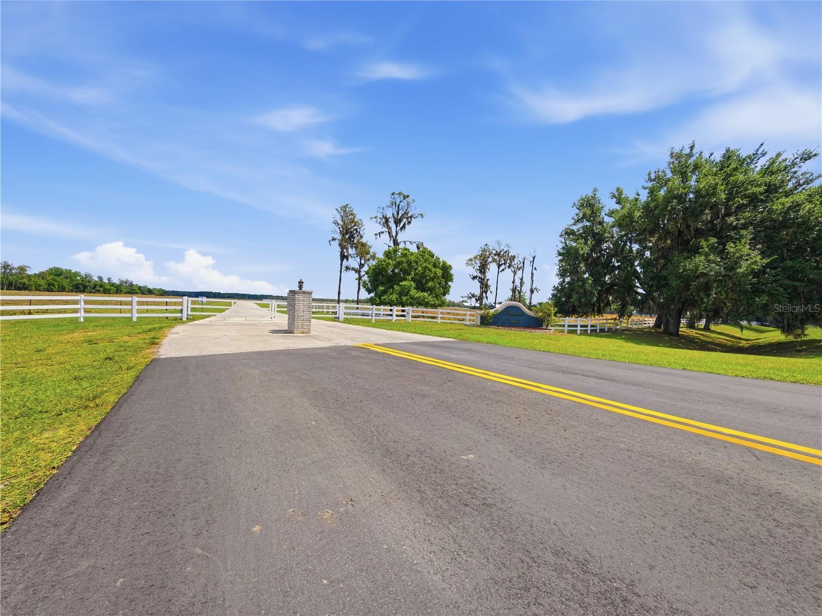
Property Photos

Would you like to sell your home before you purchase this one?
Priced at Only: $175,000
For more Information Call:
Address: 0 Gabriel Road, FORT MEADE, FL 33841
Property Location and Similar Properties
- MLS#: L4955959 ( Land )
- Street Address: 0 Gabriel Road
- Viewed: 108
- Price: $175,000
- Price sqft: $0
- Waterfront: No
- Year Built: Not Available
- Bldg sqft: 0
- Days On Market: 229
- Additional Information
- Geolocation: 27.7826 / -81.6699
- County: POLK
- City: FORT MEADE
- Zipcode: 33841
- Elementary School: Lewis Anna Woodbury Elementary
- Middle School: Fort Meade Middle
- High School: Fort Meade Junior/Senior High
- Provided by: FAITH AND FAMILY REALTY LLC
- Contact: Tiffany Williams
- 863-712-1991

- DMCA Notice
-
Description5 ACRES of OLD FLORIDA LAND! This parcel(#3) does have a gate and is partially fenced with barbed wire. There is an additional 10 acre parcel available if interested. Parcel #4.
Payment Calculator
- Principal & Interest -
- Property Tax $
- Home Insurance $
- HOA Fees $
- Monthly -
For a Fast & FREE Mortgage Pre-Approval Apply Now
Features
Building and Construction
- Covered Spaces: 0.00
- Fencing: Barbed Wire
- Living Area: 0.00
School Information
- High School: Fort Meade Junior/Senior High
- Middle School: Fort Meade Middle
- School Elementary: Lewis Anna Woodbury Elementary
Garage and Parking
- Garage Spaces: 0.00
- Open Parking Spaces: 0.00
Eco-Communities
- Water Source: None
Utilities
- Carport Spaces: 0.00
- Road Frontage Type: Access Road
- Sewer: None
- Utilities: Electricity Available
Finance and Tax Information
- Home Owners Association Fee: 0.00
- Insurance Expense: 0.00
- Net Operating Income: 0.00
- Other Expense: 0.00
- Tax Year: 2024
Other Features
- Country: US
- Current Use: Pasture
- Legal Description: THAT PART OF THE NORTHWEST 1/4 OF THE SOUTHEAST 1/4 AND THE NORTHEAST 1/4 OF THE SOUTHEAST 1/4, OF SECTION 13, TOWNSHIP 31 SOUTH, RANGE 26 EAST, POLK COUNTY, FLORIDA BEING MORE PARTICULARLY DESCRIBED AS FOLLOWS: COMMENCE FROM THE SOUTHWEST CORNER OF SAID NORTHWEST 1/4 OF THE SOUTHEAST 1/4, SAID POINT BE MARKED BY A CONCRETE MONUMENT WITH NO IDENTIFICATION, RUN THE ALONG THE WEST LINE OF SAID NORTHWEST 1/4 OF THE SOUTHEAST 1/4, N00°43'45”E A DISTANCE OF 807.85 FEET; THENCE N89°25'07”E A DISTANCE OF 50.83 FEET TO THE INTERSECTION WITH THE EASTERN MAINTAINED RIGHT OF WAY LINE OF GABRIEL ROAD ACCORDING TO MAP BOOK 22, PAGES 65-72, AND THE POINT OF BEGINNING. CONTINUE THENCE N89°25'07”E A DISTANCE OF 1280.37 FEET; THENCE S00°34'53”E
- Area Major: 33841 - Fort Meade
- Parcel Number: 26-31-13-000000-023040
- View: Trees/Woods
- Views: 108
Similar Properties
Active
$189,999.00
Tbd Timbers Drive Virtual Tour Reduced More Like This Login To Like
Beautiful lakefront lot in a private gated community just 5 minutes from Fort Meade. Enjoy peaceful surroundings and a low HOA of only $120/yearperfect for your future home.
- Approx. 2.05 acres
- Provided by LPT REALTY, LLC
- Contact Andres Quesada Suros
-
- DMCA Notice
Active

$160,000.00
10349 County Road 555 More Like This Login To Like
Rare opportunity to own 5 acres in The Ranches at Ranger Lake. This property has a private lake stocked with bass and rumor has it that bass fishing competitions were done here. This is beautiful p
- Approx. 5.03 acres
- Provided by BHHS FLORIDA PROPERTIES GROUP
- Contact Darlene Bice
-
- DMCA Notice

- Broker IDX Sites Inc.
- 750.420.3943
- Toll Free: 005578193
- support33@brokeridxsites.com